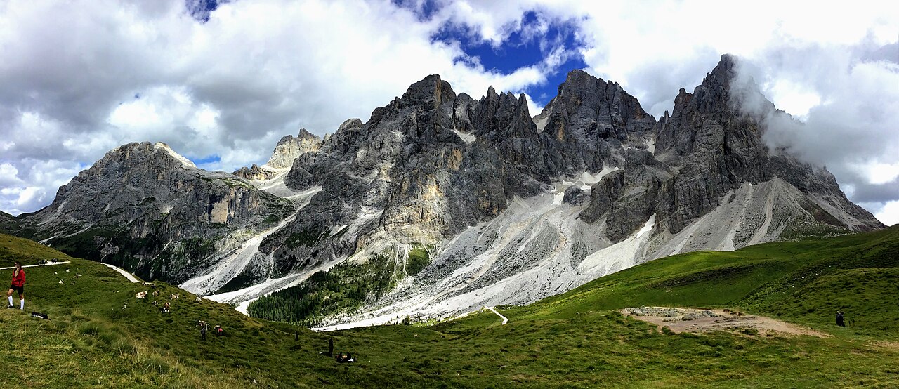

Choose the valley journey, not merely the hut
Val Venegia to Baita Segantini is the route to investigate when you want the approach to unfold beneath the Pale di San Martino. The destination is shared with a shorter walk from Passo Rolle, but the experience differs. Starting through the valley gives you forest, widening pasture and the eventual ascent towards the higher viewpoint. Choose this version because that progression appeals, not because both routes end at a name seen in the same photograph.
Pian dei Casoni is the identified starting reference for the valley itinerary considered here. Keep it attached to the map and any route figures. A distance beginning at Passo Rolle cannot assess the valley approach. A guide that says only hike to Baita Segantini leaves the most important practical question unanswered: from where, through which landscape and back to which finish?
The lower valley and the upper rise do different jobs
Official Trentino information describes the route through the Malga Venegia and Venegiota area before the upper bends towards Baita Segantini. The lower portion introduces the mountain walls in a broad valley setting; the upper portion changes the relationship by gaining the higher destination. Do not assess the full outing from the gentle appearance of the beginning. The climb still belongs to the chosen day.
A walker who mainly wants valley observation can choose an appropriate mapped shorter out-and-back rather than continue by default. A walker selecting the full valley-to-pass journey should retain enough energy for the later ascent and full return. The two intentions are compatible only when everybody knows which one the group has chosen before the outing begins.
Return by the valley or choose a genuine loop
An out-and-back returns from Segantini through the same valley approach. Its repetition can be rewarding because the mountains and pasture are seen in reverse sequence. A larger official circuit continues towards Passo Rolle and the Malga Juribello area before closing back towards Pian dei Casoni. That is a different complete line, not simply a more efficient way to descend. Assess the extra terrain and distance on its own map.
Do not arrive at the destination and select a new return solely because somebody says the loop is prettier. Your route choice affects where you finish and how much walking remains. A circuit should earn its place through the landscapes you want, not through a general dislike of retracing ground. A clear valley return may be the better holiday day even when a larger ring is possible.
Compare the three approaches honestly
The short approach is not a shortcut that preserves every aspect of the valley day. The long approach is not automatically better because it contains more ground. Choose according to whether the lower valley journey or the higher destination matters most. Those are distinct, legitimate reasons to walk.
Swipe the table horizontally to compare every column.
| Plan | Main reward | What changes |
|---|---|---|
| Val Venegia out-and-back | A sustained valley-to-high-view progression | The complete valley return remains |
| Val Venegia–Rolle–Juribello circuit | A broader loop across several settings | A larger route whose full profile needs assessment |
| Passo Rolle to Segantini and return | A shorter high-start approach to the same viewpoint | Much less of the lower valley experience |
A hut or pasture name is a navigation reference
Malga and baita names are helpful for understanding the route sequence, but they do not guarantee meals, opening or available shelter. Carry what the selected walk requires and verify any service you plan to depend on. This article deliberately omits current operating arrangements so that the enduring route decision remains clear. A facility's changing availability should not determine whether the landscape itself is worthwhile.
Do not allow the prospect of another named refreshment stop to expand the circuit beyond the route you assessed. The map should establish the day, with services as optional verified additions. A group that set out for a valley return should not be gradually moved into the larger ring through a succession of attractive hut names.
Photograph the working valley from the path
The combination of pasture, stream and rock walls can make the valley feel like a ready-made photographic foreground. Remain on designated paths and respect working land and local notices. Do not cross a stream or spread into vegetation for a cleaner frame. The authorised route already changes the view continuously. A genuine image can record that changing relationship without inventing access to every attractive patch of ground.
Light, water and the appearance of meadows vary. Choose the walk for the broader sequence so that a different cloud pattern or less vivid reflection does not turn the outing into a failed attempt at an image. Taking time to look can add more value than adding a second major hike after rushing through the valley.
Where the route fits in a holiday
Use the full Val Venegia approach as the main walking activity in this area. The Pale di San Martino setting belongs to its own geographical segment, not a small detour from every northern Dolomites base. Map the journey from accommodation before combining it with other destinations. If your time is limited, the separately assessed Rolle approach may serve the visit better than squeezing the valley day into a narrow window.
Check current official local notices, mapping and conditions for the chosen version. This guide gives no road or hut-status promises. Its lasting recommendation is to select one start and one complete return, understanding that the lower valley, the upper bends and the larger circuit each add a different part of the experience.
Questions answered
Is the Passo Rolle walk the same as the Val Venegia approach?
No. They share Baita Segantini as a destination but begin differently and provide different landscapes and effort.
Must I complete the Rolle–Juribello circuit?
No. A planned valley out-and-back is coherent. Choose the larger ring only after assessing its full route.
Sources & scope
Route facts are drawn from the resources below. The comparisons and recommendations are our research-based editorial analysis; this is not a claim of personal trail inspection. Access and conditions must be checked with the responsible land manager before travel.
- Trentino tourism: Val Venegia ring from Pian dei Casoni
- Trentino tourism: valley progression towards Segantini
Editorial standards · Explore the destination guides
Found a detail that needs correcting? Send the guide URL and a supporting source so we can review the exact route version.