
Build the trip around complete walking days
The first Dolomites planning decision is not which beautiful place to remove from a list. It is what kind of walking holiday you want. A week of open meadows, village returns and one selected panorama requires a different itinerary from a week built around high rock circuits and exposed approaches. Both can be rewarding. Problems arise when photographs from several route types are treated as interchangeable attractions, with their approach, terrain and return left until after accommodation is booked.
Begin with three complete days you would genuinely enjoy. Give each day a named start, a destination or circuit, a finish and a return arrangement. Then group them geographically. Seceda, Resciesa and Vallunga form a western valley-based pattern. Cinque Torri, Lago Federa and a lower Cortina outing form another. Tre Cime, Val Fiscalina and Prato Piazza suggest an eastern cluster. Those groupings are more useful than a supposed regional centre that leaves every morning dependent on a mountain-road transfer.
The following framework is for day hiking, with accommodation used as a base. It does not describe an overnight hut traverse, promise year-round conditions or substitute for current official trail information. The purpose is to make your choice of walks specific enough that accommodation, access and suitable alternatives can follow logically. You should be able to explain why each day belongs in the holiday before adding another celebrated place.
Recognise the five different landscapes hidden in a short wish list
Broad pasture is one route family. Alpe di Siusi and Armentara can offer long periods in meadow landscapes, but the amount of climbing depends on the chosen start. A route beginning high near Compatsch or Furnacia is not equivalent to walking up from the valley below. Meadow paths can also cover substantial ground. Choose this family for time spent within an open landscape, rather than assuming the word meadow guarantees a short or effortless day.
Enclosed valleys form another family. Vallunga near Selva and Val Fiscalina near Sesto offer walking shaped by enclosing rock walls, with lower out-and-back possibilities distinct from the routes continuing high into the mountains. Their appeal is the changing view along the valley floor and its wooded or pastoral sections. They are useful counterparts to a high panorama because the experience differs in scale and direction, not simply because they are less famous.
High viewpoints and rock circuits require more careful separation. Seceda is a ridge experience; the Tre Cime circuit moves through a mountain landscape around the peaks; a viewpoint near Cadini is a separate, potentially exposed objective. Lake names are equally unhelpful as difficulty labels. A shoreline walk at Dobbiaco is a different undertaking from the equipped and exposed approach to Sorapis. Group routes by terrain and full commitment before grouping them by the colour of the water in a photograph.
Use Val Gardena when a connected western stay fits the brief
Val Gardena is a strong first choice when you want several different landscapes without designing the whole holiday around regional crossings. Ortisei relates naturally to Seceda, Resciesa and the Alpe di Siusi side. Selva gives a stronger relationship to Vallunga. Santa Cristina suits the Col Raiser and Rifugio Firenze approaches. These are useful village distinctions within a single valley, so select an exact base after choosing which route family will occupy the most days.
For Seceda, define whether the day is a high-start walk, a complete ascent from Ortisei or a different approach through the mountain-hut network. The direct village ascent has a very different climbing commitment from arriving high and walking toward a ridge viewpoint. A route from the lower Col Raiser area through Rifugio Firenze that continues toward Seceda is not simply the hut walk. Neither the destination name nor an isolated photograph identifies how much of the mountain you intend to walk.
Resciesa provides a useful example of a bounded plateau outing. The official high-start circuit around the summit-cross and Holy Cross chapel area begins at the upper station. Walking from Ortisei to reach that level adds a separate ascent; walking back down afterward adds another section. Vallunga can then supply the contrasting valley day. A defined panorama, a selected plateau or meadow outing and a lower valley walk already make a varied short holiday without leaving the western cluster.
Separate Alpe di Siusi, Val di Funes and Alta Badia rather than merging them
Alpe di Siusi deserves an actual route choice. A Compatsch circuit through the Ritsch and Sanon area returns through the meadow network, while the Hans and Paula Steger trail toward Saltria is linear. If you choose the latter as a one-way walk, the return must be solved separately. A broad panorama does not make those two day shapes interchangeable. Select the circuit when a self-contained return matters, or the linear outing when its access and finish genuinely fit the plan.
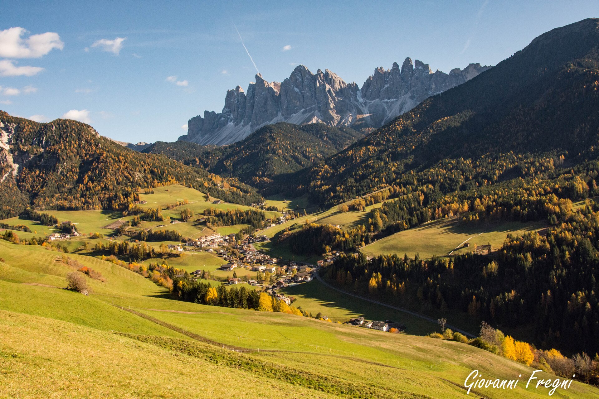
Val di Funes offers a different western experience: settled pastoral slopes around Santa Maddalena, woodland around Zans and the Adolf Munkel route beneath the Odle walls. It is particularly coherent for a focused valley stay. The mountain path gives a foothill perspective, while Seceda offers a high ridge view from another side of the group. Do not describe Adolf Munkel as simply another approach to the same photograph. The surroundings, footing and relationship to the rock walls are part of the reason to choose it.
Alta Badia suits a stay built around several village relationships. Corvara and Colfosco connect the plan to the Sella-side landscape and Borest waterfall walk. San Cassiano relates to Piz Sorega and Pralongià. Badia and La Val deserve attention for a meadow-oriented holiday around the Armentara side. The lower Corvara–La Villa walk adds a different scale. One carefully defined plateau day, a lower link and an Armentara outing can form a full local programme without an unrelated lake excursion every morning.
Choose Cortina for selected objectives with separate approaches
Cortina works particularly well when the Cinque Torri area, Croda da Lago and Passo Giau landscapes lead your priorities. Think of these as individual trailhead days. Cinque Torri can combine close rock formations with interpreted wartime history, but the tower-area walk and its approach are separate components. An official outing starting at Scoiattoli and finishing lower at Bai de Dones does not describe a full ascent and descent from the bottom. Include the access method when comparing it with another walk.
The Lago Federa outing from Ru Curto is a clear example of how to contain a mountain day. The walk uses the forest approach toward Rifugio Croda da Lago–Palmieri and returns by the selected route. Continuing around Croda da Lago through higher passes changes both the terrain and the commitment. The traverse from Passo Giau through Mondeval and Lago Federa finishes near Ru Curto instead of returning to its start. That is a transport decision as well as a walking decision.
Sorapis should be screened separately before it is placed in this group. The familiar approach from Passo Tre Croci includes exposed and equipped terrain. It is not an easy lake stroll simply because its endpoint is water. If that route does not fit the party, remove it early and retain a Cortina holiday based on suitable alternatives. A lower outing around Pian de Loa or the Ra Stua area can be investigated through the official map, using its actual start, route and conditions.
Keep the eastern valleys distinct from the Cortina cluster
Tre Cime, Val Fiscalina and Prato Piazza create another convincing first-trip grouping. The Tre Cime circuit from the Auronzo side is a substantial mountain outing, with route choices around the Lavaredo saddle, the Locatelli area and the western return. A shorter out-and-back toward Forcella Lavaredo is a different scope. The Cadini viewpoint is not a compulsory extra at the end: it is a separate narrow and exposed objective that must earn its place on suitability, rather than proximity in an online itinerary.
Val Fiscalina provides the contrasting valley experience. Define whether the walk begins farther down toward Sesto or at a selected valley trailhead before comparing distances. Reaching Rifugio Fondovalle, also called Talschlusshütte, is not the same day as continuing upward toward the high Tre Cime network. Prato Piazza offers a plateau setting, with the Monte Specie or Strudelkopf extension as another explicit decision. A published one-direction summit route must not be read as the complete return circuit.
The eastern lakes work best as carefully scoped walks or shorter landscape visits. Lago di Dobbiaco has a shoreline nature-walk identity distinct from longer regional loops reaching it. Braies requires a choice between the full shore circuit and a selected shorter return; its shores do not all have identical surfaces and steps. Misurina, Antorno and Landro offer different settings, but collecting all their names adds little if the holiday has already lost its main walking days to transfers.
A first three-day itinerary: choose one of these shapes
For a western three-day stay, build one day around Seceda with its access and return clearly defined. Choose a suitable Compatsch meadow circuit or the bounded Resciesa plateau outing for another day. Give Vallunga the third day, with an intentional turnaround appropriate to the group. The sequence contains a high view, a more open landscape and an enclosed valley. It is varied enough to stand on its own; adding Tre Cime would turn the trip into a different geographic project.
For a Cortina-focused stay, select a complete Cinque Torri day, a Lago Federa out-and-back from Ru Curto and a lower outing from the official local route network. Keep the higher day flexible within the stay when conditions permit. Substitute a more ambitious Croda da Lago route only after assessing its entire profile, rather than stretching the lake day spontaneously. Sorapis is an alternative for a suitable party, not a required ingredient of a successful first visit.
For an eastern three-day stay, give the screened Tre Cime route one day, Fiscalina another and Prato Piazza a third. Decide in advance whether Monte Specie is the plateau day’s destination or whether a more contained outing is wanted. This pattern gives rock circuit, valley and plateau rather than three similar lake photographs. Actual trailhead access and present mountain conditions still determine whether each selected route belongs on the dates of travel.
A week: deepen one area or make one deliberate move
A week does not automatically require two bases. A western stay can combine Seceda, Resciesa, Alpe di Siusi, Vallunga and a separate local mountain-hut outing, with room for a shorter day and a flexible high-level choice. An Alta Badia stay can instead develop the Pralongià, lower-valley and Armentara themes. Repeating a familiar access pattern is not wasted time when the walking landscapes differ. It can be more rewarding than constantly exchanging one village for another.
If both western and eastern objectives remain essential, divide the week into two clusters and move once. A Val Gardena section followed by a Cortina section is one coherent shape; Val di Funes followed by the eastern valleys is another when those landscapes match your interests. Put several wanted walks on each side of the move. A single lake photograph is a weak reason to relocate the entire party, whereas three contrasting local days give the second base a clear purpose.
Treat the moving day as a moving day. A short legal village walk or a contained lakeside visit can fit around it, but a high traverse with a complicated finish is a poor companion to checking out, transporting luggage and settling into another valley. Leave the most condition-dependent objective inside a multi-day stay where it has some flexibility. This is a practical use of time, not a promise that a particular weather window will appear.
Resolve the return before comparing route statistics
Three route shapes need different accounting. An out-and-back requires the return along the chosen corridor. A circuit needs the complete loop, including any section between the accommodation, access point and actual trailhead. A point-to-point route needs a separate return arrangement. A route page showing one direction, a high start or a finish at a lower station may be perfectly accurate while still omitting part of your personal day. Read the map and endpoint labels before comparing headline distance or ascent.
Names also change across languages. Zans and Zannes refer to the same trailhead area; Monte Specie and Strudelkopf identify the same summit; Rifugio Fondovalle and Talschlusshütte identify the same valley hut. Resolve these aliases before assuming that two descriptions are separate alternatives. Conversely, similar destination names can conceal different approaches. Save the official route link that matches your intended start and finish, rather than relying on a loosely named trail pin.
Where transport or lift access is part of the plan, verify the specific operating arrangement for the travel dates through the official provider. Do not copy an old timetable into a permanent itinerary or assume a descending route guarantees an available ride back. Walking all the way down can be a major addition, not an interchangeable backup. Choose a day whose complete return you can actually support instead of hoping the final connection will resolve itself.
Make the final shortlist suitable for the whole party
Screen terrain before booking around a famous objective. Exposure, equipped sections, steep loose ground and a long descent matter independently of distance. An experienced walker who dislikes exposed traverses may prefer a longer meadow route to a shorter ledge-based approach. Discuss these specific features with everyone, using current official route descriptions and qualified local advice where needed. Technical terrain should not become a surprise discovered halfway through a supposed scenic walk.
Give each base at least one genuinely wanted shorter or lower option. Vallunga, a defined Zans nature walk, a selected lower Alta Badia link or an appropriate Cortina valley outing can each serve that role in the correct cluster. None is an all-weather guarantee, and none needs to be padded to equal the distance of the main day. Its purpose is to keep the holiday coherent when energy, conditions or preferences call for a different scale.
The final plan should fit on one simple list: base, named route, complete start and finish, access and return, terrain concerns and a local alternative. Check official weather-related notices, closures and access information shortly before the walk. Once those decisions are sound, stop adding distant attractions merely to make the itinerary look comprehensive. A first Dolomites trip succeeds when the selected days work together and the walking itself has room to become the main experience.
Questions answered
Can beginners hike in the Dolomites?
Yes, when they choose suitable complete walks. Valley outings and selected meadow routes differ greatly from exposed approaches such as Sorapis. Assess the exact terrain, ascent and return rather than using the destination name as a difficulty rating.
Is one week enough for the whole Dolomites?
A week is enough for a satisfying selected area or two carefully grouped bases. It is not a reason to include every famous ridge and lake across the region.
Do I need to use lifts?
No, but a village-start ascent can be much larger than a route beginning at an upper station. Compare the complete walking versions and verify any planned lift access for your dates.
Should I book accommodation before selecting trails?
Choose a small route cluster and suitable base first. Then compare accommodation addresses within that area, checking the actual starts and returns for the walks you intend.
Sources & scope
Route facts are drawn from the resources below. The comparisons and recommendations are our research-based editorial analysis; this is not a claim of personal trail inspection. Access and conditions must be checked with the responsible land manager before travel.
- Val Gardena official hiking directory
- Alta Badia official hiking routes
- Cortina official trekking directory
- Cortina official Sorapis route
- Official Tre Cime walking circuit
- Official Adolf Munkel route
Editorial standards · Explore the destination guides
Found a detail that needs correcting? Send the guide URL and a supporting source so we can review the exact route version.