
Identify the right Blea Tarn
Blea Tarn is a repeated place name in the Lake District, so the route needs a geographical qualifier. This guide concerns the tarn between the Langdale landscapes, with the National Trust starting area near the road between the valleys. It is not a route to another water of the same name elsewhere in the national park. Use the Langdale setting and the named land-manager route when checking maps or photographs.
The managed trail is a compact out-and-back. Its purpose is to bring a walker close to the tarn and onward toward a wider view without a major fell ascent. That is a complete objective in its own right. A visit here does not need to be transformed into a summit circuit to feel worthwhile, and the view across the water does not require leaving the established path for an invented photographic shortcut.
The first view is not the whole route
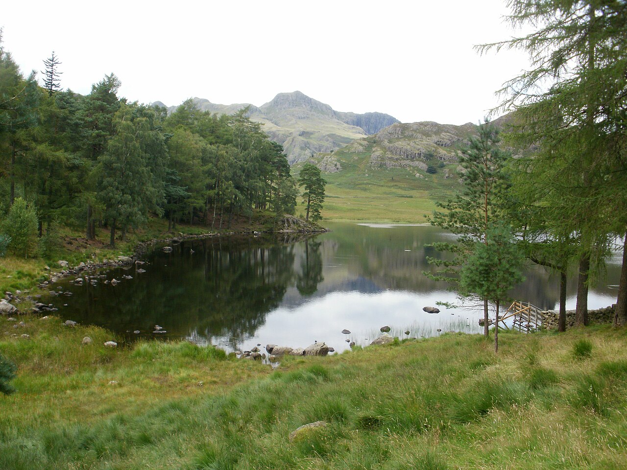
From the defined start, the route crosses the road and descends toward the tarn. The opening lake view is the image most people recognise, but it is only one part of the walking sequence. The path continues toward the outflow and a footbridge, then enters a wooded section before reaching more open ground. This progression provides variety in a relatively small area.
If the immediate shore is the intended goal, choose that as a shorter return and measure it accordingly. If completing the land-manager trail, account for the sections beyond the first photograph. A compact destination can still contain several distinct stages. Naming them makes the plan clearer than saying there will be a short walk around the lake, which may imply a full perimeter circuit that is not the route being described.
The path is improved but the landscape still undulates
The National Trust describes a compacted-stone walking surface with gentle changes of level, while noting that wet or muddy ground can occur. Those details support a more useful assessment than a universal claim about suitability. A surface can be reasonably consistent without becoming identical to a pavement. Examine the specific route description if equipment or a particular mobility requirement determines the choice.
The approach also includes a descent from the starting area, so the final return contains the corresponding rise. This is a small but worthwhile scheduling detail. Do not mentally finish the outing at the last shore photograph if you still need to retrace the woodland and climb back toward the start. The route’s modest scale makes those connections manageable to understand, but they remain real parts of the walking day.
Why continue to the open viewpoint?
Beyond the wooded section, the path reaches open ground with a broader view into the Langdale landscape. The interest changes from the tarn as a foreground subject to the surrounding valley as a whole. This is the strongest reason to complete the defined trail instead of stopping immediately beside the water. It adds a different perspective rather than simply more distance.
The contrast works in reverse on the way back. After the larger valley view, the woodland narrows attention again before the tarn reappears. This is why an out-and-back need not feel repetitive. The order of scenes changes, and the light or framing may look different without any need to chase a more hazardous position. Walkers interested in photography can use the established route to compare these perspectives rather than assuming a circular journey is necessary for visual variety.
Looking back toward the tarn gives a southern perspective toward Little Langdale, while the open endpoint introduces Great Langdale. These are two valley relationships within one small outing, which is why the final viewpoint adds more than another photograph of the same shore.
The return choice: path or road
The National Trust explicitly recommends retracing the trail rather than returning along the road to create a circle. That is a useful example of route shape being less important than the quality of the walk. A loop is not inherently better than a return journey. Here, staying with the path maintains the woodland-and-water sequence that motivated the visit.
Choose the out-and-back when Blea Tarn itself and the valley outlook are the focus. If you arrive on foot from another settlement, such as Elterwater, treat that approach as a separate extension and calculate the complete journey. The short trail’s distance cannot describe a day that includes a longer valley connection. Keep the route definition honest: the managed Blea Tarn outing is a bounded path-based experience, while wider Langdale circuits are different plans requiring their own assessment.
A small water with a major mountain backdrop can be a useful first Langdale outing precisely because the view is not conditional on climbing those mountains. Preserve that distinction in the itinerary: the tarn trail offers a low perspective on high scenery, not a shortened ascent of the skyline.
Scale of the complete managed outing
The National Trust lists this defined Blea Tarn out-and-back as approximately 2.88 kilometres, with an indicative one to two hours. The complete outing returns to the named car park; it is not a full shore-perimeter circuit and does not include a walking approach from Elterwater. This is useful for selecting a contained Langdale landscape day alongside the much larger valley or fell routes.
Questions answered
Does the official trail circle the entire tarn?
It is described as an out-and-back with a continuation toward a wider Langdale viewpoint. Do not assume that a full perimeter loop is the intended route.
Why return the same way?
The land manager recommends the path return rather than the road circuit. Retracing also gives a second sequence through the open view, woodland and water instead of adding a road leg simply to create a loop.
Sources & scope
Route facts are drawn from the resources below. The comparisons and recommendations are our research-based editorial analysis; this is not a claim of personal trail inspection. Access and conditions must be checked with the responsible land manager before travel.
- National Trust: Blea Tarn trail
- National Trust: Langdale walking collection
- National Trust: Langdale route-start geography
Editorial standards · Explore the destination guides
Found a detail that needs correcting? Send the guide URL and a supporting source so we can review the exact route version.