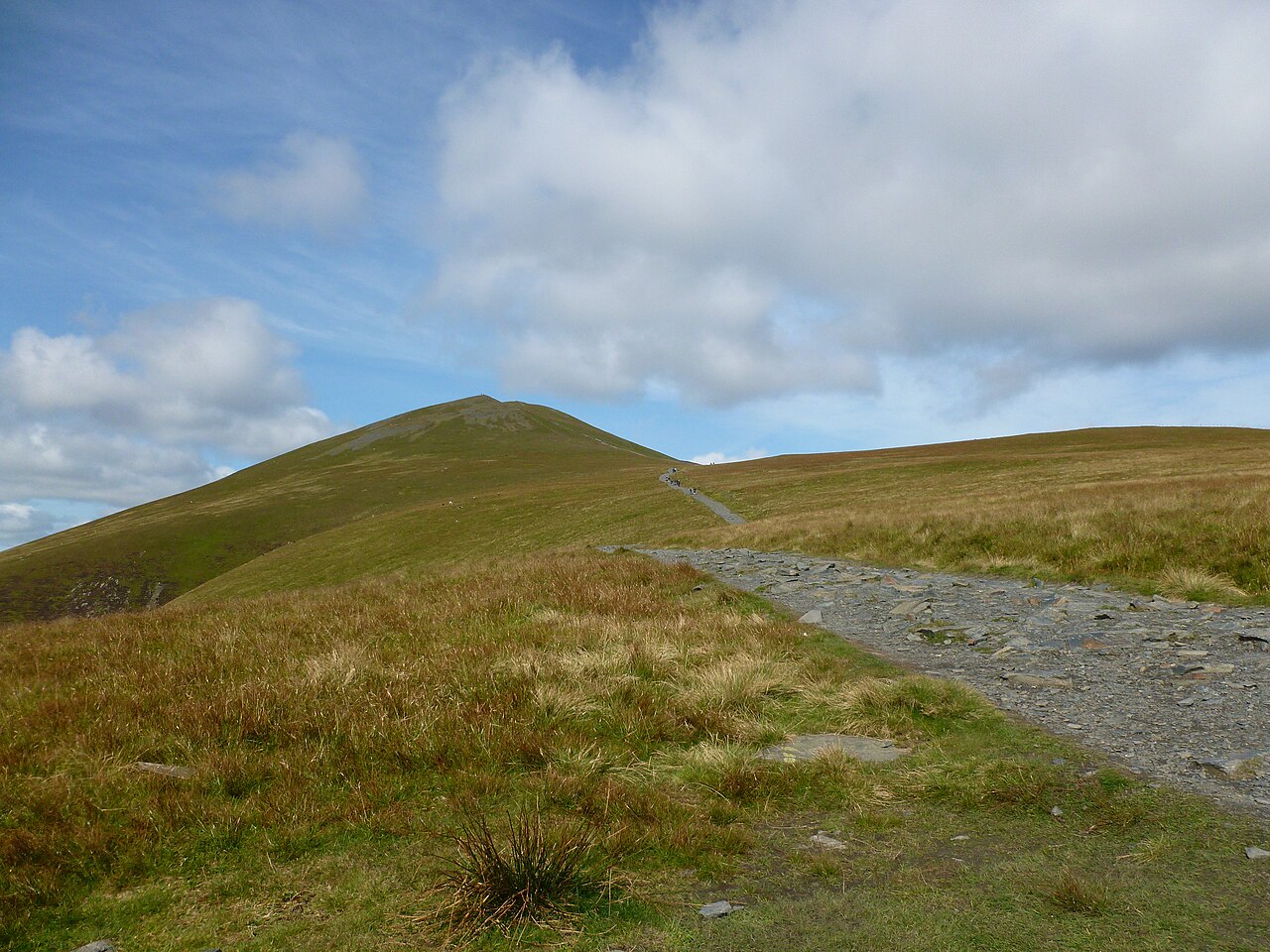

One mountain approach, more than one starting point
Skiddaw forms a large part of Keswick’s northern skyline. The Jenkin Hill approach is a well-known walking line, but descriptions begin at different places. The local tourism association publishes a route from the Moot Hall in Keswick, while other accounts begin higher near the Latrigg starting area. Those are not competing measurements of one identical day. The town start includes a lower climb and the final return through the same corridor.
Decide which version you intend before using a distance or duration. A walk from your accommodation in Keswick may be attractive precisely because it begins on foot, without a transfer to an upper start. That convenience does not remove the added distance. The route should be described honestly as a town-to-mountain outing rather than borrowing the shortest figure associated with the summit name.
The lower approach shares a corridor with other walks
The Keswick account passes through the town-side landscape toward Spooney Green Lane and crosses above the A66 before continuing uphill. This corridor also connects with Latrigg routes. A sign mentioning a nearby fell does not mean that the smaller summit must be included. The route you have selected is heading toward Skiddaw via Jenkin Hill, with the lower paths serving as its approach.
This overlap is useful when planning different days in Keswick. Latrigg can provide a separate compact viewpoint outing, while Skiddaw becomes a more substantial ascent. Combining them simply because the paths are close may dilute that contrast and add effort without resolving a real travel problem. Keep the chosen objective clear and use junction names to understand where routes separate. The common approach does not make the destinations equivalent in scale.
The open climb is the central work
Beyond the lower approach, the route gains height on the Jenkin Hill side and moves into a more open mountain environment. The local tourism route describes a clear stony path, but clarity of line is not a measure of physical ease. A sustained climb can be demanding even when no dramatic rock obstacle appears in the photograph. The amount and continuity of the ascent deserve their own place in the decision.
For a party choosing between Skiddaw and a short viewpoint, this is the meaningful difference. The mountain is not just another rise beyond Latrigg. It has a larger upper landscape, a longer ascent and a return that must be completed after the summit. Describe those features rather than relying on the reassurance that the path is obvious. A clear path can help explain the route while leaving all the walking effort intact.
Little Man is a route choice, not a compulsory addition
The Jenkin Hill line and the upper Skiddaw landscape are associated with nearby tops, including Little Man. A full plan must distinguish the main route from optional summit additions. The local published descent uses the flank relationship rather than requiring every neighbouring high point. If a separate top is desired, it belongs in the route calculation and map rather than being added because it is visible.
The same principle applies at the summit ridge. Reaching Skiddaw is not an instruction to explore every continuing line before choosing a way down. Retain the intended return toward Jenkin Hill and the original start. Other paths on the mountain may lead to different valleys or create larger circuits. They are legitimate subjects for separate plans, not interchangeable ways home for a day whose finish is Keswick.
A mountain day from town, or a smaller first outing?
The Keswick tourism association presents its complete town-start route as roughly ten miles. That figure is useful mainly because it establishes the scale of that particular version. It is not a target time or a promise that every walker will experience it similarly. A transfer to an upper start changes the approach, while a nearby summit extension changes the upper day. Keep the definition attached to the measurement.
Choose the full Keswick ascent when the substantial climb and town-to-mountain connection are what you want. Choose Latrigg separately when the goal is an introductory view over the settlement and lake. Neither choice needs to be justified by a list of completed summits. A well-planned Skiddaw day has enough purpose in its sustained ascent, open upper ridge and clear return. Its value comes from matching that scale to the party, not from making the mountain sound easier than it is.
The summit ridge can make the surrounding northern landscape feel broad and open after the concentrated ascent. That change is a reason to choose the mountain day, but it also shows why the return should remain attached to a known line rather than whichever departing path seems most direct.
The Moot Hall outing occupies the main walking day
Keswick Tourism Association gives its ten-mile Moot Hall route an indicative five to six hours. Those figures belong to the complete town-start Jenkin Hill outing, including the return from the upper route to Keswick. They make the practical comparison with Latrigg explicit: Latrigg is the compact introductory town viewpoint, while Skiddaw is the substantial mountain day. A high starting-point version or a Little Man addition is a different route and should not inherit the same total automatically.
Questions answered
Does a clear path mean Skiddaw is a short or easy walk?
No. Path definition and physical effort are different factors. The Jenkin Hill route includes a sustained ascent and a full mountain return.
Can I use an upper-start distance when walking from Keswick?
No. Include the lower approach and its return. A route measured from a higher start describes a different walking journey.
Must I include Latrigg or Little Man?
No. They are separate objectives or route additions. Keep them out of the plan unless their extra distance and terrain are part of the intended day.
Sources & scope
Route facts are drawn from the resources below. The comparisons and recommendations are our research-based editorial analysis; this is not a claim of personal trail inspection. Access and conditions must be checked with the responsible land manager before travel.
- Keswick tourism: Skiddaw via Jenkin Hill
- Lake District National Park: Latrigg starting geography
- Keswick tourism: Underskiddaw landscape
Editorial standards · Explore the destination guides
Found a detail that needs correcting? Send the guide URL and a supporting source so we can review the exact route version.