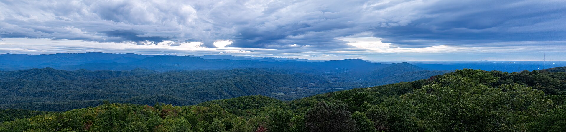

Begin with four kinds of experience
A first Smokies hiking trip becomes manageable when you separate four interests: river walking, forest observation, a waterfall destination, and mountain views. They can overlap, but none guarantees the others. A forest trail may have no panorama; a waterfall may require a substantial climb; a short paved viewpoint path may be steep. Write down the two experiences that matter most before selecting famous trail names.
Then choose a geographical center for each day. The park stretches across Tennessee and North Carolina, with several valleys and ridge access points. A list mixing Cades Cove, Deep Creek, Cosby, and a LeConte ascent is not yet an itinerary. Each route needs its own start, endpoint, return, and approach from the place you stay. The plan becomes useful when those complete days are visible rather than hidden behind a collection of appealing photographs.
Sugarlands and Elkmont: flexible valley and forest choices
Sugarlands is a useful first reference for smaller walking subjects. Fighting Creek Nature Trail supports a forest-and-cabin visit, with the Cataract Falls branch treated as a separate addition. Gatlinburg Trail creates a linear river-and-history connection toward town. Choose the nature loop for a compact local subject; choose the town connection when its complete start and finish suit your day. A shared visitor-center area does not make the routes identical.
Elkmont provides a different lower-valley menu. A selected Little River out-and-back follows the river and former railroad setting with a flexible agreed turnaround. The Little River–Cucumber Gap–Jakes Creek circuit adds a narrower undulating connector and a different finish relationship between nearby trailheads. Choose the circuit for that variation, not simply because loops sound better. For a first moderate forest day, the out-and-back can be the clearer shared choice, while the circuit deserves its own complete assessment.
The Townsend side: distinguish cascade, gap, and Cades Cove
The Middle Prong start in the Tremont area supports a defined shorter return toward Lynn Camp Prong Cascades. Schoolhouse Gap provides a gradual former-road woodland outing with named junctions that can structure a full or shorter return. These are different subjects: moving water along a historical grade versus steady forest walking toward a gap. Choose according to what the group wants to spend time observing, not a promise that every trail on this side is gentle.
Cades Cove introduces another geographical day. Abrams Falls can be the main hike, with its complete forest return kept separate from the loop-road visit. A smaller history-focused plan can instead use designated short walks to preserved buildings. Do not promise the drive, every historic stop, wildlife sightings, and a substantial waterfall outing as if each were only a few minutes. Select the principal purpose and let the remainder remain optional.
Greenbrier and Cosby: match the destination to the approach
In Greenbrier, Porters Creek offers useful scope choices: a history detour, the Fern Branch Falls return, or a separately researched longer trail. Ramsey Cascades is a substantially larger ascent whose broad beginning changes to narrower, rockier terrain. Choose Porters when the selected history-and-water scope fits the group; choose Ramsey when the full forest ascent is the day you actually want. The two trailheads are different, and the shared regional label does not turn them into one convenient combination.
Cosby offers another pair of distinct interests. Hen Wallow Falls is a waterfall return on Gabes Mountain Trail with steeper and uneven sections. Albright Grove is a forest destination reached by a substantial Maddron Bald approach before the small internal loop. The loop's short standalone figure must not conceal the whole hike. Choose one according to subject and complete effort rather than regard old-growth forest as an automatically easy alternative to a mountain-view route.
The high ridge: compare effort patterns, not only mileage
Newfound Gap supports the Appalachian Trail return to Charlies Bunion, a substantial ridge outing that rises and falls before reaching its rocky setting. The road overlook and the hike are separate activities. Choose the full trail when the ridge journey and endpoint both suit the group. A person can enjoy long forest walks yet dislike an exposed destination, so discuss that feature separately from general fitness.
Near Kuwohi, the observation tower is reached by a short but steep paved climb. Andrews Bald uses Forney Ridge Trail for a longer descent through forest to an opening, followed by climbing back. These are not interchangeable short viewpoint walks. Choose the tower for its structure and possible panorama; choose the bald for the forest-to-opening journey and accept the uphill finish. Shared arrival geography does not make both compulsory, especially after another substantial hike.
The Cherokee side: river, nature loop, bridges, or cascade
Oconaluftee River Trail offers a lower-valley linear route from the visitor and Mountain Farm Museum area toward Cherokee. It can be paired with interpretation when the complete approach and return fit. Choose the river and cultural landscape as the purpose, with wildlife as a possible observation rather than a guaranteed endpoint. A same-path return is a practical outing even without a summit or waterfall.
The Smokemont and nearby menu has several different scales. Smokemont Nature Trail is a compact loop with its own bridges and climb, not the much larger Smokemont Loop. Chasteen Creek Cascade uses Bradley Fork and a selected branch for a fuller water-focused return. Kephart Prong provides a steady stream-and-bridge ascent toward historical camp remains and the shelter area. Compare those actual features, particularly crossing comfort and return effort, rather than describe every southern-side forest route as equally easy.
The Bryson City side: choose waterfall circuit or forest history
Deep Creek's official three-waterfall loop connects Juney Whank, Indian Creek, and Tom Branch Falls through several trail segments. Its steeper opening makes it different from the shorter creek return toward Indian Creek that also includes Tom Branch. Choose the geometry first and let the waterfall count follow. A two-fall outing walked attentively can be a better match than a circuit selected only because three sounds more complete.
Goldmine Loop via the official Tunnel Bypass scope offers a different forest-and-history subject near the Lakeview Drive end area. It includes an approach associated with Lakeshore Trail and a selected circuit, not the entire Lakeshore route. Treat it as a separate day or principal outing rather than an invisible extension of a tunnel stop. A Bryson City-centered visit can gain variety from pairing water one day with forest traces another, without crossing the park for every new landscape.
Choose a base from two priority days
If the main days are Sugarlands, Elkmont, and a selected Newfound Gap Road mountain outing, investigate a Gatlinburg-side base against the exact starts. If the repeated subjects are Tremont, Schoolhouse Gap, and Cades Cove, a Townsend-side emphasis may fit more naturally. These are geographical recommendations, not hotel rankings or guaranteed travel times. An accommodation's actual address and final approach matter more than a broad gateway label.
On the North Carolina side, Cherokee fits an Oconaluftee–Smokemont emphasis, while Bryson City fits Deep Creek and Lakeview Drive interests. A short visit usually benefits from a coherent side of the park rather than repeated cross-park journeys. A longer stay with several priority days in different regions may justify a divided base, but include the disruption of moving in the comparison. Do not move accommodation merely to get closer to one optional short walk while making the rest of the trip more complicated.
A concrete three-day selection, with a smaller alternative
For a Tennessee-side first sequence, begin with a defined Little River return and an optional Elkmont history visit. Choose a second day's main mountain objective: Alum Cave Bluffs for geology and a bounded turnaround, Charlies Bunion for a substantial ridge journey, or the full LeConte outing only when the whole mountain day is independently appropriate. Use the third day for a different subject, such as a selected Tremont cascade return or a Cades Cove history-focused visit. These are choices, not all compulsory stages.
For a less strenuous sequence, replace the mountain day with the Fighting Creek nature-and-cabin subject or another fully assessed lower-valley outing. On the North Carolina side, a coherent alternative is an Oconaluftee river-and-interpretation day, a selected Smokemont-area forest or cascade day, and a Deep Creek waterfall route with its actual scope understood. Either sequence provides variety through landscape rather than increasing effort daily. Final ordering depends on official guidance and the group, not a rigid calendar template.
Read the complete route before choosing its reputation
For each outing, place four items together: start, endpoint, return line, and approach from the base. This catches the assumptions that popular names hide. Albright Grove's small loop requires an approach; Andrews Bald descends before the return climb; a LeConte route does not end simply because one viewpoint has been reached. A one-way trail also needs a real final connection, not a hope of finding transport afterward.
Compare surface and effort pattern with recent experience. Someone may be comfortable with distance but prefer broad paths to narrow bridges, or enjoy uphill walking but dislike a long descent. Those are useful planning constraints. For mobility-specific decisions, consult detailed official route information rather than rely on a general easy category. The right choice is the route whose actual features fit the people, not the one they ought to manage according to a label.
Use scope choices without creating pressure
Alum Cave Bluffs and Mount LeConte via Alum Cave are different outings despite their shared lower approach. Rainbow Falls and the larger LeConte route on that trail are also different. The shorter objective should be selected positively, not presented as a failed summit attempt. Agree the intended endpoint before departure so one person's enthusiasm at a landmark does not rewrite the day's commitment for everyone else.
A split group requires each party to have suitable preparation, a complete route, and resolved meeting arrangements. It is not enough to leave somebody waiting at a waterfall while another party decides how far to continue. Often one shared smaller outing and a separately organized larger day work better. A mixed-ability trip can be active and satisfying without forcing the strongest walker to define every route's scale.
Make photography and observation part of the time budget
A waterfall viewing area, a cabin, or a grove can invite a long pause. Include that time instead of assuming it will fit inside the fastest possible walking estimate. Use established positions and leave passage for others. The photograph should follow the route boundary: no water entry, cliff pose, informal shortcut, or protected-root detour is required to make a legitimate visit worthwhile.
Choose a subject suited to the day. At Albright, compare forest structure; at Deep Creek, notice the different forms of three falls; at Elkmont, connect the river route with visible history; at Kuwohi, the tower and forest can matter even when cloud obscures distant ridges. This makes the actual landscape sufficient. A missing rainbow, limited flower display, or absent wildlife sighting should not turn the day into a search for a more dramatic unofficial endpoint.
Keep changing information in a departure note
Access, cautions, weather, and relevant services require official checks near the outing. Keep those details separate from the permanent reasons for choosing a route. This guide does not publish parking prices, road schedules, permit procedures, or present trail status. Use the NPS map and route pages for the exact line, then the current cautions for the actual day. A trail described in a guide is not automatically appropriate whenever you arrive.
A fallback should be another researched route with a clear purpose, not simply something lower or shorter assumed to be suitable. If conditions or the group rule out a ridge day, a forest, river, or interpretation-focused day may preserve the trip's variety more honestly than a smaller version of the original ambition. The finished plan is a set of complete days you can explain: geographical center, main outing, return, and one optional addition that can disappear without making the visit incomplete.
Questions answered
Do I need Mount LeConte on a first hiking trip?
No. River, forest, waterfall, and viewpoint routes can create a varied visit. Choose LeConte only when the complete mountain outing is a priority that fits the group.
Which side should organize a short stay?
Use your two priority days. Repeated Tremont and Cades Cove subjects suggest a different emphasis from Oconaluftee, Smokemont, and Deep Creek interests.
Should I plan several waterfalls each day?
Usually choose one complete principal route. Waterfalls can require very different approaches, and a linked circuit such as Deep Creek should be planned as one outing rather than separate thin stops.
What needs a final official check?
The actual route's access, cautions, weather, and any service on which the day depends. Permanent route character does not establish current suitability.
Sources & scope
Route facts are drawn from the resources below. The comparisons and recommendations are our research-based editorial analysis; this is not a claim of personal trail inspection. Access and conditions must be checked with the responsible land manager before travel.
- NPS: Smokies day-hike directory
- NPS: Oconaluftee walking area
- NPS: Deep Creek walking area
- NPS: Official maps
- NPS: Current cautions for departure checks
Editorial standards · Explore the destination guides
Found a detail that needs correcting? Send the guide URL and a supporting source so we can review the exact route version.