
A town viewpoint with a real ascent
Orrest Head rises above Windermere town, close enough to its transport interchange to work as a walking objective without a separate journey into a mountain valley. Its appeal is the contrast: streets and buildings give way to woodland, then the trees open onto a broad view across the lake landscape. That makes it useful for an arrival day when you want to understand where you are before planning farther outings.
It remains a climb. A short approach from town does not make the summit level with the station, and the restored path does not remove every steep section. The national park includes Orrest Head within its Miles Without Stiles collection but uses its conditional “for some” category. Retain that qualification. The route is an improved way to reach a fell viewpoint, not a universal promise about every walker, mobility aid or path in Elleray Wood.
Find the correct woodland line
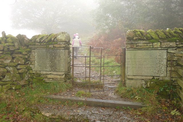
The official route begins at the narrow lane beside the lower entrance to the Windermere Hotel. From there it uses a combination of paved approach and the restored carriageway through Elleray Wood. The important distinction is the signed route colour: the national park directs visitors needing the step-avoiding line to the blue-marked route. Other woodland paths branch away and can involve steps or different surfaces.
This is a case where following the shortest-looking path can defeat the reason for choosing the walk. A direct branch may not share the main route’s characteristics. If your plan depends on a surfaced approach, maintain that route through the woodland rather than treating every summit arrow as equivalent. The journey is not a race for the smallest distance. A slightly more winding line may be precisely what makes the chosen route appropriate.
Think in approach, carriageway and final rise
The early lane establishes that the outing climbs from the start. The carriageway then gives a more winding passage through the trees. Near the upper wood, the route emerges toward the open viewpoint. That three-part structure is easier to remember than a dense sequence of tree names and house landmarks, and it helps you place the view in the context of the approach.
The woodland is part of the experience rather than a screen to get past. Its enclosed paths make the final opening more noticeable, while the bends mean you encounter the landscape gradually. The historical carriageway also explains why one line is wider and more engineered than nearby footpaths. Choosing it is therefore both a practical route decision and a way to understand the designed access to the viewpoint. Keep the ascent and descent on the same selected line if those characteristics matter to your party.
Do not confuse outward distance with the whole outing
Orrest Head descriptions sometimes present the distance to the upper turning point and elsewhere describe the complete return. The official material includes both an outward figure and a roughly three-and-a-half-kilometre return description. Rather than treating these as competing estimates, check the stated endpoints. The summit is the outward objective; Windermere is the return finish.
Add the connection from your own starting place. A walk beginning at accommodation elsewhere in town may include more streets than one beginning beside the named lane. A visit from Bowness is different again because Bowness and Windermere town are not the same point on the map. The useful calculation is the actual journey you will walk, including the return through Elleray Wood. Borrowing a short summit distance without its definition can quietly turn an arrival stroll into a longer outing than intended.
What the official ascent figure measures
The national park gives approximately 120 metres of ascent for the Orrest Head approach through Elleray Wood. That figure describes climbing on the selected route, while the summit height of 238 metres describes altitude above sea level. The two measurements answer different questions. The page’s overall description identifies a roughly 3.5-kilometre return, while its distance field shows the shorter outward line. For a town-start return, count both directions and use the blue route throughout when its surface characteristics determine the choice.
Make the summit view the goal
From the open top, the relationship between the long lake and the central fells becomes the main subject. Give that panorama enough time to be useful. Identify the northern end of Windermere and the direction of the higher ground rather than assuming you need another destination immediately afterwards. The summit’s orientation features can help connect names on your map with the terrain in front of you.
A direct return to Windermere completes a coherent town-to-viewpoint walk. Adding Bowness or a lakeshore route can be enjoyable, but it is a second geographic decision rather than part of the basic Orrest Head route. On an arrival day, finishing the woodland return with time left in hand may be preferable to linking several attractions simply because they share the name Windermere. The short walk does its job when you leave with a better understanding of the landscape and a clear sense of the ground you have walked.
A useful arrival-day test is whether the whole party wants an uphill woodland outing before settling into town. Orrest Head can provide a first geographical overview, but the summit panorama should not be used to conceal the effort of getting there and returning through the same woods.
Questions answered
Are all paths through Elleray Wood step-free?
No. The national park distinguishes the blue-marked route from red-marked alternatives that can contain steps and other different ground. Follow the specific line that matches the requirement you planned for.
Is Orrest Head on the Windermere lakeshore?
No. It is above Windermere town. The viewpoint looks over the lake landscape, but reaching the shore is an additional journey and should be counted separately.
Sources & scope
Route facts are drawn from the resources below. The comparisons and recommendations are our research-based editorial analysis; this is not a claim of personal trail inspection. Access and conditions must be checked with the responsible land manager before travel.
- Lake District National Park: Orrest Head route
- Lake District National Park: public-transport walking ideas
- Visit Lake District: Windermere and Bowness
Editorial standards · Explore the destination guides
Found a detail that needs correcting? Send the guide URL and a supporting source so we can review the exact route version.