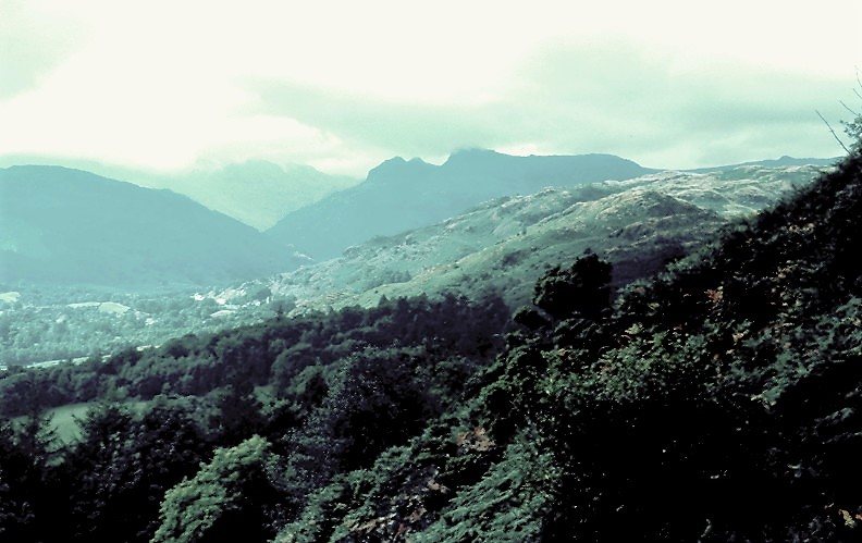

Begin with one route shape
Loughrigg is surrounded by several settlements, lakes and paths, which explains why it appears in so many different walking guides. A route from Ambleside is not interchangeable with an ascent from Grasmere or a stroll along Loughrigg Terrace. The regional tourism authority describes an Ambleside circuit that climbs from the eastern side, reaches the summit and returns through the Red Bank and terrace landscape. That sequence offers a useful starting point for a complete plan.
Draw that circuit before adding anything else. Ambleside is the start and finish, the summit is the principal high point, and the terrace belongs to the descent and return. A guide that approaches from another valley may contain helpful background but will not supply the missing connections automatically. Loughrigg’s modest height can disguise how many directions are available once you are on its broad ground. A named sequence is more dependable than assuming every visible path eventually leads back to town.
Why the eastern ascent makes a coherent beginning
From Ambleside, the eastern approach near the River Rothay allows the walking day to gain height early. The climb becomes the main work of the outward journey, leaving the rest of the circuit to change views and bring you back through lower ground. This suits visitors who prefer a clear effort at the beginning rather than an uncertain collection of rises spread across several optional detours.
That preference is not a claim that all climbing ends at a particular point. A fell landscape can contain small dips and rises even on a broadly descending route. The useful distinction is structural: you are moving toward one summit first, not tracing a lakeside path and deciding later whether to climb. It also gives the day a clear objective. If the ascent proves to be enough, the summit circuit can stand on its own without needing another lake or village to justify the outing.
Keep the summit separate from the terrace and tarn
Loughrigg Fell is the high ground and summit objective. Loughrigg Terrace is a path along the fell’s side, associated with views over Grasmere. Loughrigg Tarn is a separate body of water below another part of the fell. Each name can be the centre of a satisfying walk, but none should be used as shorthand for the others when assessing distance or terrain.
For example, an article praising a terrace walk may be describing a route that never reaches the summit. A tarn circuit can begin elsewhere and remain below the high ground. If your goal is the summit from Ambleside, retain that goal in the map and route notes rather than borrowing the easiest description attached to a nearby name. Conversely, there is no need to climb the fell if the terrace view is what actually interests you. Choosing a lower destination deliberately is better than treating it as a failed summit attempt.
Choose the version by its principal view
Choose the Ambleside summit circuit when the goal is a broad orientation to the central fells: start from Ambleside, make the eastern ascent from the River Rothay side the main uphill stage, and retain Red Bank and Loughrigg Terrace in the return framework. Choose a terrace-focused outing when the desired reward is the view over Grasmere and a summit is unnecessary. Choose a Loughrigg Tarn outing when the water itself is the destination. These choices are not interchangeable shorter labels for the same circuit.
For a first Ambleside stay, the summit circuit and a separate Grasmere–Rydal Water day make the stronger pairing. One day is about open high ground and valley orientation; the other is about two waters and their wooded connection. Attaching both complete lakes to the summit outing uses up that contrast in a single enlarged day and leaves the return less legible.
Use Red Bank as a return landmark, not a new objective
The regional route description identifies the Red Bank and terrace side as the return framework after the summit. These names help you understand which side of Loughrigg you are using. They do not remove the need to follow the complete mapped connection back to Ambleside. Once down from the summit, it is easy to be drawn toward another inviting lake path or village and quietly change the walk from a circuit into a different journey.
This is the point at which an honest distance definition becomes useful. The tourism authority presents its Ambleside outing as a six-mile route. That figure belongs to its specified circuit. If you descend into Grasmere village, add a full lake circuit, or seek out Loughrigg Tarn, you must calculate a new total rather than continuing to describe the day with the original mileage. The scenery is connected, but the route measurements are not transferable without checking the line.
Published scale for this Ambleside version
The regional tourism authority lists the Ambleside Loughrigg Fell outing as six miles, with a typical three to four hours. This is the summit-and-return version discussed here, not a measurement for Loughrigg Terrace alone or a full two-lake circuit. Use that scale when deciding whether the fell should occupy the main walking day; it is not a short viewpoint stop to fit automatically around another complete route.
When to choose this circuit over the two-lake alternative
Choose the summit circuit when you want open fell walking and an elevated orientation to the central Lake District. Loughrigg’s relatively isolated position is a large part of its appeal: the outlook changes as you move across the high ground rather than being dominated by a single neighbouring slope. The return then gives a different, lower perspective on the same landscape.
Choose a Grasmere and Rydal Water route instead when the primary interest is a lake-to-lake journey with less emphasis on reaching a summit. Those waters can be combined into a coherent walk of their own. Trying to include both complete lakes and the full Ambleside fell circuit often makes the day less clear rather than richer. For a first visit, one well-understood high route or one well-understood low route is usually the more satisfying choice. You can return to the other landscape on a separate day with fresh attention.
Questions answered
Can I use the terrace walk’s description to judge the summit circuit?
No. The terrace is one feature on Loughrigg’s side, while the summit circuit adds an ascent and different ground. Compare routes with the same endpoints and complete line.
Does the Ambleside circuit need an extra visit to Loughrigg Tarn?
No. The summit and terrace circuit already forms a complete outing. A tarn detour should be added only after its connections and extra distance have been calculated.
Sources & scope
Route facts are drawn from the resources below. The comparisons and recommendations are our research-based editorial analysis; this is not a claim of personal trail inspection. Access and conditions must be checked with the responsible land manager before travel.
- Visit Lake District: Loughrigg Fell route
- Lake District National Park: Grasmere Trail
- Lake District National Park: walking route collection
Editorial standards · Explore the destination guides
Found a detail that needs correcting? Send the guide URL and a supporting source so we can review the exact route version.