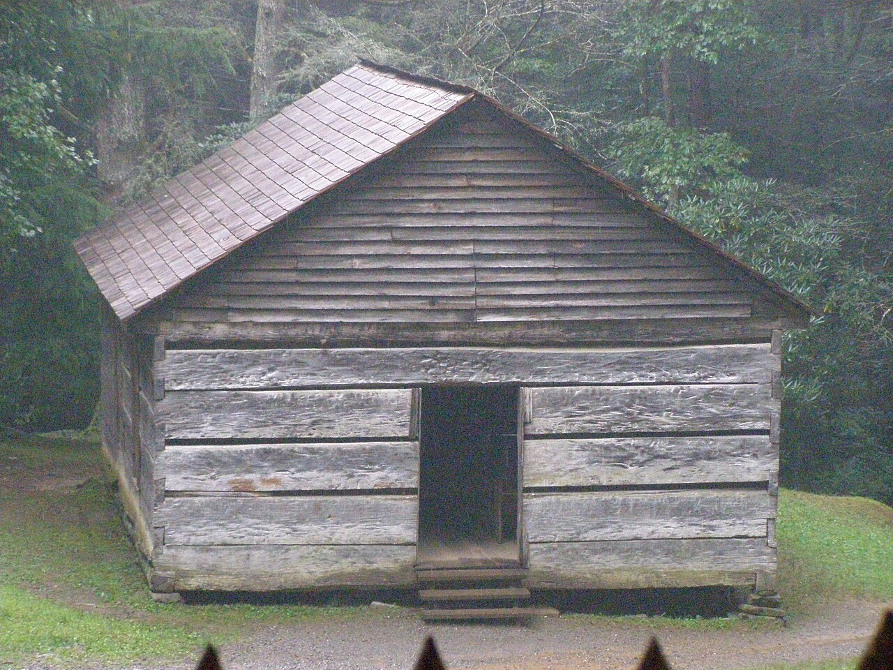

Choose the historic destination you actually want
Little Greenbrier School can be the destination of a forest walk from Metcalf Bottoms. The school-and-Walker homesite combination is a larger outing described by the NPS, but the school does not require that continuation. Choose the scope before leaving so everybody knows whether the building is the endpoint or a stage in a longer day. A history walk should not keep growing because another historic feature lies farther up a signed route.
This guide focuses on the school as a complete objective. It does not assign the combined outing's published distance to the shorter return. That distinction matters when somebody chooses a modest walk for the group. A correct figure for a larger route can still be misleading if its endpoint is silently changed in the description.
Begin at the Metcalf Bottoms walking approach
Use the Metcalf Bottoms Trailhead across the bridge from the picnic area, following the official map and signs toward the school. The school can also appear in accounts using road access, but that is a different arrival arrangement. For a walking day, define the complete approach and return from the place you will actually begin. Do not compare every account mentioning the school as if it measures the same route.
The NPS describes the trail climbing through hardwood forest. That gives the visit a journey rather than a simple step from a vehicle to a building. Choose it if the group wants that approach. If the interest is only the structure and walking is a constraint, consult current official access information separately instead of inventing a shortcut or assuming a road will be available.
The school is more than a photographic facade
The park identifies the one-room building as a school, church, and community gathering place. Those roles make its setting a useful subject for observation. Look at the building's scale, the surrounding ground, and the relationship between the route and the site. You do not need a long catalogue of dates or unsupported stories to understand why one structure could matter to a small mountain community.
Use interpretation for specific historical details and follow instructions about access. A preserved building is not automatically open for unrestricted entry or exploration around every adjacent feature. Respect the cemetery and other sensitive parts of the setting. The practical hiking recommendation is to leave time to observe thoughtfully, rather than treat the school as a quick photograph before hurrying toward another destination.
Keep the Walker continuation explicit
The continuation changes the historical subject. Little Greenbrier School represents shared community life: one building served school, church and meeting functions. The Walker homesite represents a household landscape, including the cabin, springhouse and corn crib described by NPS. From the school, the combined route follows Little Brier Gap Trail uphill on a broad gravel roadbed; the official school-plus-homesite outing from Metcalf Bottoms is 3.4 miles return. Choose school-only for a focused communal-building visit and the same approach back. Choose the combination when comparing public and domestic mountain life is worth the additional uphill walking, not merely because another old building is signed.
If the group wants the combined route, use the dedicated official description for its full scope and return. If the group chose school-only, retrace the researched approach from the school area. The decision should not be made by pressure at the building, where one person may feel obliged to accept more walking to avoid disappointing another. A clear initial agreement protects the value of the smaller outing.
Do not confuse Schoolhouse Gap with the school trail
Schoolhouse Gap Trail is a separate woodland route beginning from Laurel Creek Road. Its name can appear in similar searches, but it does not take the place of the Metcalf Bottoms school walk. Choose the gap for a gradual former-road outing; choose Little Greenbrier School for this historic-building destination. The similar words do not establish a connection between the routes.
That distinction is especially useful when combining days from different online lists. Check each actual trailhead and endpoint before drawing a route between them. A mountain place name can be repeated in several contexts without describing one unified attraction. Accurate geography prevents a short history walk from becoming a drive to the wrong start followed by an entirely different hike.
A family or mixed-interest history day
The school provides a goal that is easy to explain to a group: walk through forest to a specific building, spend time understanding it, and return. That clarity can be useful for children and adults with different walking ambitions. It is not an age-based suitability promise. Read the actual surface, climbing, and approach details against the people who will use the route.
The picnic-area geography can support an unhurried day when current arrangements fit, but this article does not publish facility hours or promise a particular service. Keep any separate meal or interpretation visit in the schedule without making it a reason to rush the trail. The building and forest journey can be enough; a waterfall or summit need not be added to make the outing feel like a proper park visit.
A practical route boundary to retain
Record the Metcalf Bottoms start, school objective, and same-route return, with the Walker extension listed only if deliberately included. Confirm official access and cautions near travel. The enduring value is the choice of scope: a defined school history walk rather than a vague instruction to keep following old buildings uphill. That specificity gives the day a clear purpose, an honest walking commitment, and time to appreciate the people whose landscape the route passes through.
Questions answered
Does the school visit include Walker Homesite automatically?
No. The homesite is a farther continuation with its own added walking. Choose the school-only or combined scope before departure.
Can I use the combined route's distance for the school-only walk?
No. Match measurements to the actual endpoint and starting arrangement.
Is this Schoolhouse Gap Trail?
No. Schoolhouse Gap is a different route from Laurel Creek Road. This walk begins in the Metcalf Bottoms area.
Sources & scope
Route facts are drawn from the resources below. The comparisons and recommendations are our research-based editorial analysis; this is not a claim of personal trail inspection. Access and conditions must be checked with the responsible land manager before travel.
- NPS: Little Greenbrier School place information
- NPS: Metcalf Bottoms school and Walker route relationship
Editorial standards · Explore the destination guides
Found a detail that needs correcting? Send the guide URL and a supporting source so we can review the exact route version.