
- Official return distance
- 1 mile / 1.6 km
- Surface and grade
- Paved; very steep
Short and paved are not the same as level
The Kuwohi observation tower is reached by a short paved climb from the designated arrival area. The NPS describes the path as very steep. That is the feature to assess before selecting the walk for a group. A one-mile return may look modest beside long mountain routes, but someone whose main difficulty is sustained grade may still find this the wrong choice. Do not let pavement erase that distinction.
Choose the visit for the tower and high-elevation setting, with its possible broad panorama as part of the attraction. The route is not a simple roadside step-out. Everybody should understand that the structure is reached by a climb and that the descent remains afterward. A clear expectation is more useful than telling the group it is only half a mile each way and leaving the steepness unmentioned.
Use the current name and recognize older references
Kuwohi is the current name for the mountain that older visitor material commonly calls Clingmans Dome. The Cherokee name was restored in 2024. A guide can help readers connect the references without creating separate pages that imply two different destinations. When using an old photograph or account, check that the route and starting assumptions still match the official current information.
The place has significance beyond a photo viewpoint. Treat the restored name respectfully and use reliable interpretation for its cultural context rather than invent a simplified story. For planning, the immediate benefit is clarity: the tower, arrival area, and nearby Forney Ridge branch belong to one geographical setting even when older labels differ. A naming change should not create unnecessary confusion in an itinerary.
The tower itself is a subject worth seeing
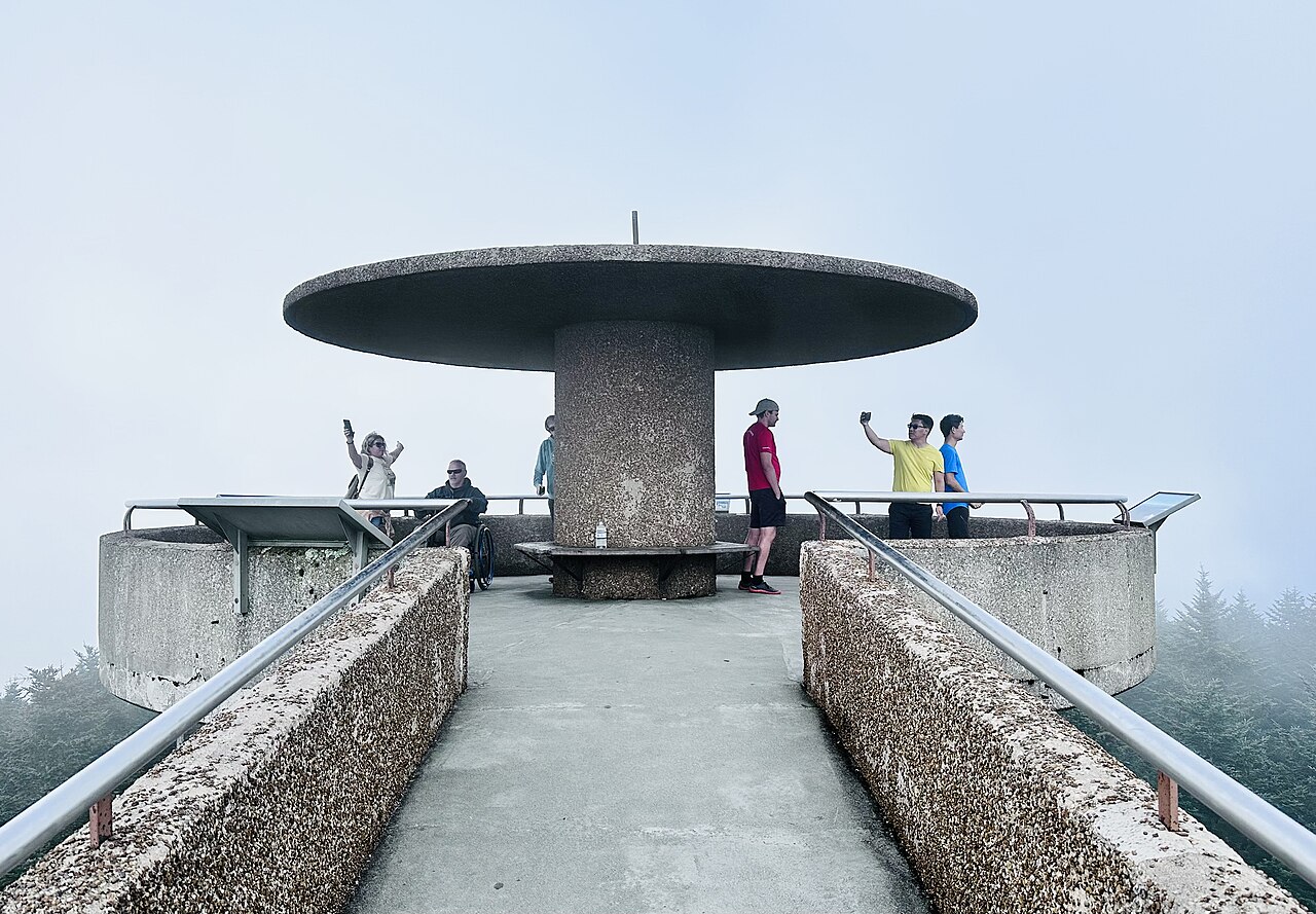
The circular observation structure and its ramp give the endpoint a distinctive architectural character. The NPS identifies it with the Mission 66 period of park development. You can observe how the ramp rises through the trees and how the structure changes the relationship between visitor and surrounding forest. That gives the stop interest even when distant mountains are not fully visible.
A visit should not depend entirely on a clear horizon. Clouds and weather can obscure the panorama, so do not promise a particular number of ridges or a precise distant landmark. The forest, the built form, and the experience of reaching a high setting remain concrete subjects. If the view is limited, decide whether those interests justify the climb for your group rather than search for a different unofficial vantage beyond the route.
Allow the grade to set the pace
A shorter route can encourage unrealistic timing because visitors imagine that the small distance will be completed quickly. Give the group room to climb at its actual pace and use appropriate places for pauses without blocking the path. The goal is an enjoyable visit, not proving that a published estimate applies to everyone. The return should remain unhurried as well.
For mobility-specific requirements, consult the detailed official information and the person who will use the route. A paved surface is not sufficient evidence of suitability when the grade is steep. Avoid universal claims based on photographs of the ramp or a general accessible-looking design. The complete approach from the actual arrival point is what matters to a real visitor.
The nearby forest routes are separate choices
The NPS describes another trail approach involving the Forney Ridge area, and Andrews Bald also begins nearby. These are not shortcuts to recommend casually when the paved climb sounds demanding. Different surfaces and profiles create different questions. Use the official map and dedicated descriptions to select a route on its own terms, rather than assume an alternate line must be easier.
Andrews Bald provides a longer forest journey toward a grassy opening, with climbing on return. It can complement a tower visit for a group that wants both complete outings, but shared arrival geography does not make the combination automatic. If the tower is the main objective, let it be enough. If the bald is the main hike, keep the tower optional according to time and energy after returning.
Make photographs fit the visitor setting
At the tower, use the provided observation and walking space while leaving room for others. The architecture offers ways to show scale without a dramatic pose near an edge. A picture of the ramp and surrounding trees can tell a different story from a wide mountain panorama. The visit does not need an image that conceals all other visitors to feel authentic.
If cloud changes while you are there, decide on a reasonable pause rather than wait indefinitely for a scene promised online. The group still has the descent and the rest of the day to consider. A viewpoint's uncertainty is part of visiting a real mountain. Planning with that uncertainty makes the experience more pleasant than treating visibility as something the itinerary should control.
A complete small mountain visit
Confirm official access and current route guidance near departure; this article does not publish a road-opening date or facility hours. Its lasting recommendation is to assess the steep grade, use the current destination name, and give the tower's structure and setting value alongside the possible panorama. That creates a complete visit without pretending the paved route is effortless or adding another trail simply because it begins nearby.
Questions answered
Is Kuwohi Tower a level accessible stroll?
The official description emphasizes a steep paved climb. Use detailed information for the actual visitor's needs rather than infer suitability from pavement.
Is Clingmans Dome another location?
It is the former name commonly found in older material for the current Kuwohi destination.
Will the tower always have a clear panorama?
No. Visibility changes. The architecture and high-elevation forest setting can still provide a worthwhile subject when the distant view is limited.
Sources & scope
Route facts are drawn from the resources below. The comparisons and recommendations are our research-based editorial analysis; this is not a claim of personal trail inspection. Access and conditions must be checked with the responsible land manager before travel.
Editorial standards · Explore the destination guides
Found a detail that needs correcting? Send the guide URL and a supporting source so we can review the exact route version.