
Define a walking goal rather than a summit claim
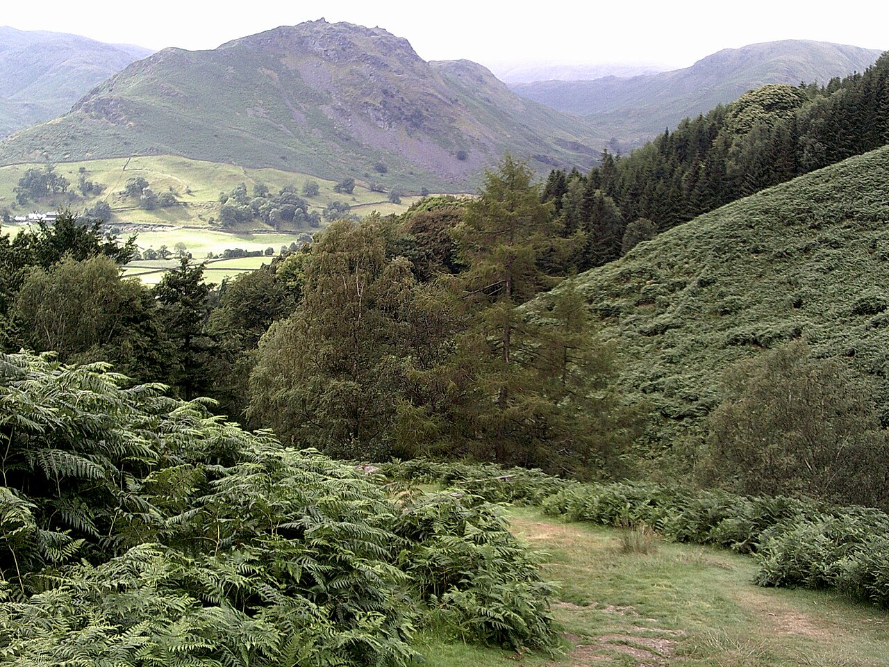
Helm Crag stands immediately north of Grasmere and is recognisable from the village because of its rocky skyline. The visible shapes have acquired names including the Lion and the Lamb, while another upper feature is associated with the Howitzer name. These labels can make route research confusing: a photograph of a rock silhouette is not the same thing as a description of the walking ground leading toward it.
For an ordinary day walk, define the objective as the upper fell and its views. This keeps the route’s purpose clear without making a climb onto the highest rock compulsory. The landscape is rewarding from the established walking ground, and there is no need to convert a short fell outing into a technical exercise to justify the journey. This guide addresses that walking day, not instructions for climbing the summit rocks.
Grasmere gives the ascent its context
The village is a coherent base because the fell’s relationship with the surrounding valley is visible from the start. The usual approach uses the Easedale side before turning toward Helm Crag’s rising ground. That makes the walk a transition from settlement and enclosed valley to an exposed upper landscape. Use a complete mapped route from the chosen village start rather than connecting a few summit photographs into an improvised line.
The regional tourism authority describes the outing as short but steep. Those words should be read together. The compact distance is an advantage for a focused walking day, but the climb is still the principal physical element. A person who has enjoyed a flat lake circuit has not necessarily encountered the same demand. Discuss the uphill and rocky character explicitly when choosing it for a group, particularly if the fell’s closeness to Grasmere has made it look like a casual stroll.
Do not let the skyline set the standard of success
Rock formations are memorable because they change shape with the viewing angle. A feature that looks like an animal from one part of the valley can look entirely different from another. That is a good reason to pay attention to the landscape on the ascent. It is not a reason to stand on the most dramatic object in every photograph.
Keep the distinction between reaching upper walking ground and climbing a rock feature. The former is the purpose of this route assessment. The latter involves different demands and is deliberately outside its scope. If somebody in the party is counting a highest point, settle that expectation before leaving rather than allowing it to emerge as pressure at the top. A useful walking goal is a place where everyone can comfortably spend time looking across the valley and then begin the planned return. It need not be the highest possible centimetre of rock.
A direct return preserves the compact day
For a first visit, a return toward Grasmere on the known approach has a clear advantage: the route remains bounded by the original objective. The descent also reveals how steep sections felt on the way up, which is useful experience for choosing subsequent fell walks. Do not assume that descending will simply take a fixed fraction of the ascent time. The surface and the group’s comfort on steps or rocks still matter.
A continuation along the ridge creates a different outing, with additional distance, junctions and a return valley to identify. It may be attractive for experienced walkers who have selected that longer route, but it is not the automatic homeward leg of every Helm Crag ascent. The fact that the ridge continues clearly in front of you does not mean it brings you back to the village by the same scale of journey. Choose a full ridge circuit from its own map and description if that is the desired day.
Where Helm Crag fits in a Grasmere stay
Helm Crag works well as a distinct fell day alongside a separate low-level lake or river outing. The contrast is stronger than trying to combine every nearby name into one ambitious circuit. Grasmere and Rydal Water provide a different style of walking; the Coffin Route provides another way to move through the valley’s human landscape. Those alternatives should not be presented as interchangeable substitutes for the same terrain.
If the party wants a view above the village and is comfortable with a sustained short ascent, Helm Crag is a logical candidate. If the priority is a gentle valley journey, choose the lower route directly rather than hoping the ascent will resemble it. A successful itinerary gives each day a clear role. Here that role is a compact, steep climb to upper fell views, with the rock skyline appreciated as scenery and the return chosen before the walk begins.
Which Grasmere day solves your actual brief?
Choose Helm Crag when the group wants a sustained steep ascent and an upper-fell view, with a direct return preserving a compact mountain day. Choose the Coffin Route when the interest is the historic connection between Grasmere and Rydal, with slope-side views but no summit objective. Choose the Grasmere–Rydal Water circuit when a complete low-level journey between two lakes is the attraction. The latter two still have slopes and uneven ground; they answer different landscape interests rather than guaranteeing smooth access.
For two days based in Grasmere, pair Helm Crag with one lower route instead of trying to combine all three. Pick the Coffin Route for settlement and cultural geography, or the two-lake circuit for water and woodland. This gives each outing a separate purpose and avoids using Helm Crag’s short-distance reputation to conceal a much larger linked circuit.
Questions answered
Do I need to climb the highest rock to enjoy the walk?
No. The upper fell’s established walking ground provides a worthwhile goal. This guide does not include climbing instructions for the highest rock feature.
Is a ridge extension part of the normal return?
Not automatically. It changes the route’s distance and return geography. A direct return toward Grasmere is the clearer option for a compact first visit.
Sources & scope
Route facts are drawn from the resources below. The comparisons and recommendations are our research-based editorial analysis; this is not a claim of personal trail inspection. Access and conditions must be checked with the responsible land manager before travel.
- Visit Lake District: Helm Crag
- Lake District National Park: Grasmere and Rydal
- Visit Lake District: Ambleside and Grasmere walking geography
Editorial standards · Explore the destination guides
Found a detail that needs correcting? Send the guide URL and a supporting source so we can review the exact route version.