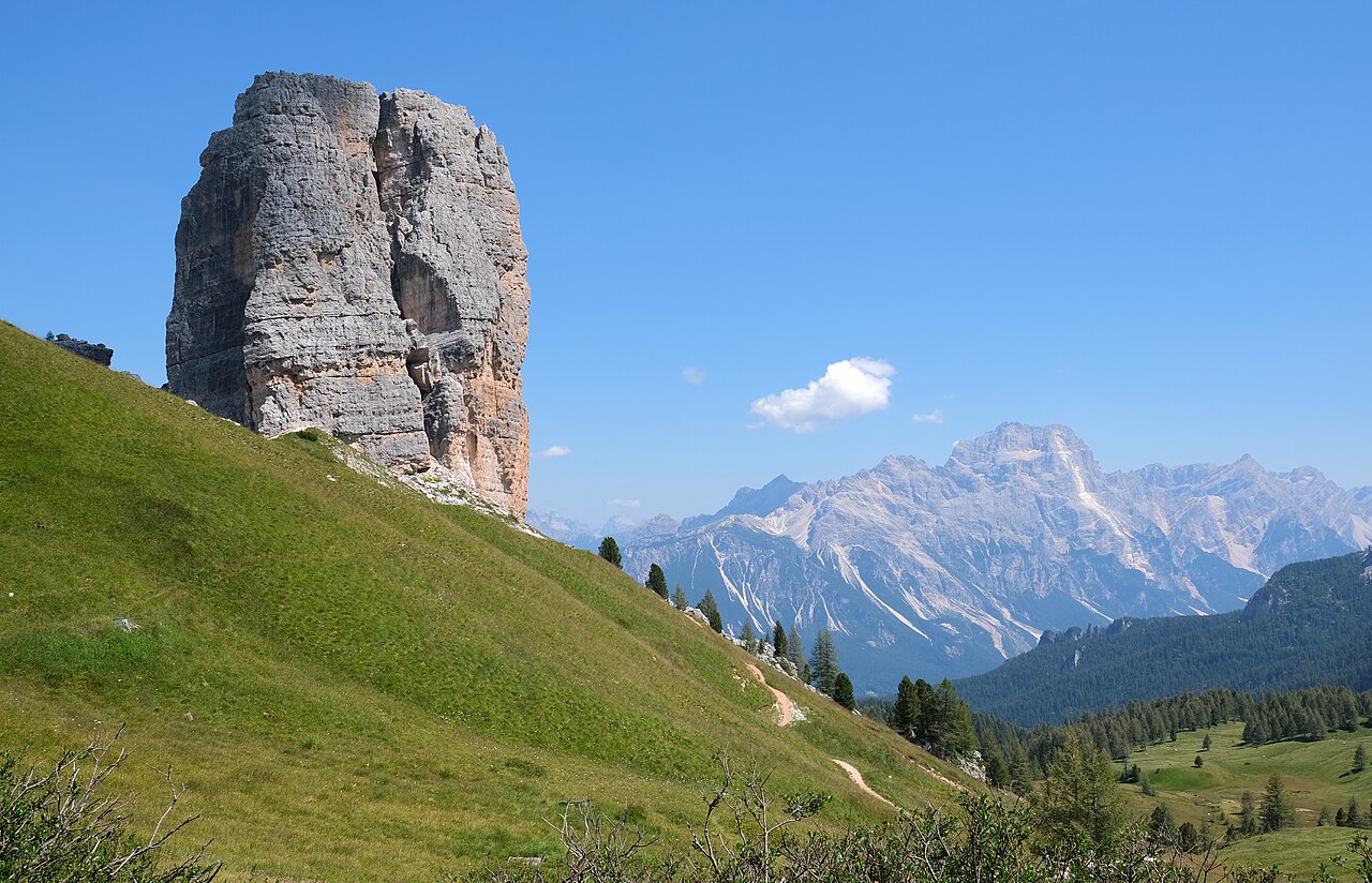

A tower circuit needs an approach plan
Cinque Torri is an excellent setting for a walk organised around rock forms and publicly interpreted mountain history. But the phrase circuit around the towers can conceal the effort of reaching them and returning. Before comparing distances, identify the actual start: the higher Rifugio Scoiattoli area, Rifugio Cinque Torri or a lower road-side trailhead. These are different places, not interchangeable names for one hut beside the same loop.
For a first visit, keep the walking focus on the established paths around the towers and the public history route. Then choose an independently understood approach and return. The local circuit's appeal does not require adding a higher summit or a climbing route. It comes from moving around the formations, noticing their changing shapes and understanding the historical landscape through designated interpretation.
Read the Scoiattoli-to-Bai-de-Dones listing correctly
Cortina tourism describes an itinerary beginning at Rifugio Scoiattoli and finishing at Bai de Dones, with a substantial net descent. Its4.7kilometre listing is not a same-start-and-finish walking circuit that includes climbing from the lower area. The description uses lift access for the beginning. If you want a wholly on-foot day from below, that access effort must be researched and counted separately.
This is a practical example of how a correct published figure becomes misleading when moved under a different headline. Keep start, finish and access mode attached to the statistics. Do not choose the shortest listed distance and assume it describes whatever route a mapping app draws around the towers. Your itinerary needs one coherent line from the place you actually begin to the place you intend to finish.
Why the rocks reward a circuit
The tower group changes dramatically with angle. A formation that appears as one solid mass from one side separates into distinct shapes as you walk. That makes a local circuit genuinely different from simply looking at the group from the arriving hut. It is also a satisfying objective for somebody who wants close mountain detail rather than only distant panorama. Give the near landscape time instead of immediately asking which summit should follow.
Use designated paths and appropriate stopping places. The towers are also a climbing venue, but climbers' lines are a different activity. Do not interpret equipment, traces or people on the rock as directions for the walking route. The interest of observing the formations does not require touching their steep faces or entering a technical route.
History belongs on the public interpretation route
The official tourist walk includes interpreted First World War remains. That adds another layer to the outing, but it should be approached through the designated route and verified public information. There is no need to invent personal wartime stories or explore unmarked passages to make the place meaningful. The relationship between terrain, observation positions and surviving features can already be understood from the authorised visitor setting.
Keep the historical walk distinct from the region's equipped tunnels or technical mountain routes. A public trench interpretation and an exposed passage elsewhere in the Dolomites do not have the same requirements simply because both are associated with military history. The subject matter of a route cannot establish its suitability. Read the specific line and activity before deciding.
Choose one complete day shape
Choose the first when your priority is time among the towers. Choose a descending version only when the complete access and finish work. Choose a full walking ascent because you want that larger day. None is inherently more authentic; they allocate effort differently. The important point is to avoid borrowing the easiest pieces from all three and imagining they describe one route.
Swipe the table horizontally to compare every column.
| Plan | What it means | What must be counted |
|---|---|---|
| Local tower-and-history circuit from a high start | Concentrate on the formations and public interpretation | Access and the return to that start |
| Scoiattoli-to-Bai-de-Dones descending itinerary | A higher start and lower finish | The verified access arrangement that creates that start |
| A wholly walking day from below | Approach, local exploration and descent | The entire uphill and downhill route, not only the local circuit |
Do not make Nuvolau or Averau an automatic extension
Higher mountain names appear close to Cinque Torri on a map, and a recognisable hut on a skyline can make another ascent look irresistible. Keep those objectives outside the local circuit unless they were researched as part of the complete day. Each can change effort, terrain and return arrangements. The tower walk is already a coherent activity without a higher finish.
This restraint is especially useful after a substantial approach on foot. A person who arrived by lift and recommends an upper extension has begun a different day from someone who has already climbed from below. The shared location at the moment of comparison does not erase the different effort already spent. Use your own full plan rather than somebody else's remaining energy.
A deliberate and satisfying visit
Allow the tower circuit and history route time for looking, reading and pauses. A bare moving-time estimate cannot describe that experience. If your return depends on a service, verify it directly and leave room for the actual visit. This guide provides no schedules, prices or operating promises. If walking down, retain enough time and energy for the selected descent rather than treating it as a formality.
Consult current local notices and a detailed map before going. The lasting lesson is the difference between the near-tower experience and the route needed to reach and leave it. Once those parts are clear, Cinque Torri can supply a rich day of real landscape and history without being inflated into a chain of unplanned summits.
Questions answered
Does the official4.7km itinerary include climbing from Bai de Dones?
That Cortina description begins at Rifugio Scoiattoli and finishes lower at Bai de Dones. It does not represent a complete on-foot ascent and return from below.
Are the rock-climbing routes part of the circuit?
No. Stay on the designated walking and public interpretation paths. Technical climbing is a separate activity.
Sources & scope
Route facts are drawn from the resources below. The comparisons and recommendations are our research-based editorial analysis; this is not a claim of personal trail inspection. Access and conditions must be checked with the responsible land manager before travel.
- Cortina tourism: Scoiattoli-to-Bai-de-Dones tourist route
- Cortina tourism: Cinque Torri public history setting
Editorial standards · Explore the destination guides
Found a detail that needs correcting? Send the guide URL and a supporting source so we can review the exact route version.