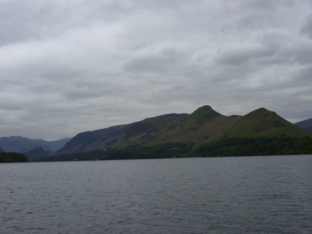

Choose the right version of Cat Bells
Cat Bells sits on the western side of Derwentwater, with Hawes End below its northern end. The familiar walk is an ascent along the north ridge, followed by a descent toward Hause Gate. From that saddle, a path drops toward the lake and connects with the lower return north. This forms a different day from simply climbing to the summit and retracing the same ridge. Decide which journey you intend before comparing distances from different guides.
The distinction matters because “Cat Bells from Hawes End” is often used for both versions. A figure measured from the roadside is not necessarily the same as one measured from the landing stage. Similarly, adding the lakeshore produces a longer but more varied route than reversing the ascent. This guide concentrates on that ridge-and-shore circuit. It does not include Maiden Moor, High Spy or a Newlands round, all of which change the scale of the outing.
Scale of the Hawes End ridge-and-shore circuit
Keswick Tourism Association’s Hawes End circuit is approximately 5.7 kilometres, with a suggested three hours plus stops. It climbs Cat Bells, descends south to Hause Gate and returns through the Brandelhow shore paths to Hawes End. Those figures describe the full published circuit, not a one-way summit ascent or the larger Maiden Moor continuation. The approach from Keswick and any lake crossing are separate from that walking estimate.
From Hawes End to the north ridge
If beginning at the Hawes End landing stage, the first task is to leave the shore and connect with the established Cat Bells approach above the road. Hawes End is an access point, not a promise that the summit path begins beside the water. The local launch operator’s walking account identifies this connection and notes that the preferred initial line may be adjusted to reduce erosion. Follow the maintained route on the ground rather than a narrow worn shortcut copied from a photograph.
Once on the ridge, the walk becomes an ascent rather than a lakeside ramble. Stone underfoot and rocky interruptions distinguish it from the paths around Derwentwater. A route that gains its height over a compact horizontal distance can demand more concentration than a longer woodland circuit. Judge whether everyone is comfortable with that style of walking before making the summit the day’s fixed objective. This is especially relevant when somebody expects the word short to mean smooth or nearly level.
The ridge is the experience, not merely the approach
The north-ridge line gives changing views across the lake as height is gained. Think of the ascent as a series of ground changes: the initial path, steeper stony climbing, rocky passages, and more open upper ground. The skyline can suggest that the next rise is the finish, but a ridge can contain several apparent tops. A map is more useful than repeatedly estimating the endpoint by eye.
It is reasonable to choose Cat Bells because the ridge itself appeals. It is less convincing to choose it solely because its summit appears close to the start. In a mixed group, discuss the rocky ground explicitly. A person who happily walks a long distance beside a lake may not enjoy negotiating short rock steps. That difference is a route preference, not a failure of fitness. There is no benefit in discovering the mismatch only after committing to the northern ascent.
At Hause Gate, keep the journey bounded
After the summit, the established circular arrangement continues south to the saddle of Hause Gate, then turns east toward Derwentwater. The name of the saddle is useful because it marks a choice between returning toward the lake and carrying on into a larger fell walk. A line continuing south is visually tempting, but it is not the homeward leg of the compact Cat Bells circuit.
Descending toward the shore changes the day’s character. Instead of revisiting the north ridge’s upper ground, the circuit trades that repetition for a longer lower-level return. This can be attractive when the group wants a complete landscape sequence: ascent above the water, a summit view, then woodland and lakeside walking. It still requires enough time and attention for the descent. Reaching the top does not mean the walking day is almost finished, particularly when the finish is the landing stage rather than the nearest roadside junction.
Choose the return that matches the outing
The circular route returns north through the lower Derwentwater landscape toward Hawes End. Keep your actual endpoint in mind: the landing stage, a prearranged pickup or another independently planned starting point. Do not assume that passing a different jetty completes the same journey. High Brandelhow and Hawes End are separate places, and an abbreviated boat-linked route is a different plan from walking the full circle.
An out-and-back is simpler to describe because it uses familiar ground, but it revisits the ridge’s rocky sections in descent. The circular alternative avoids that repetition while adding lower walking. Neither is automatically preferable for every group. Select the circuit for variety and a defined shore return; select a shorter objective only when its descent and endpoint have also been considered. Operational details of boat travel belong with the operator, while the route decision should stand independently of a remembered departure time.
Questions answered
Does the summit mark the end of the difficult walking?
No. A circular day still includes the descent to Hause Gate, the drop toward the shore and the lower return. Treat the summit as the high point of the route rather than its finish.
Is Cat Bells a substitute for a smooth lakeside walk?
Not if the reason for choosing the lakeshore was to avoid rocky climbing. Cat Bells adds a ridge ascent and different ground. Compare that requirement with the actual group rather than using distance alone.
Sources & scope
Route facts are drawn from the resources below. The comparisons and recommendations are our research-based editorial analysis; this is not a claim of personal trail inspection. Access and conditions must be checked with the responsible land manager before travel.
- Keswick Launch: Hawes End to Brandelhow via Catbells
- Keswick tourism: Cat Bells and lakeshore route
- Lake District National Park: Derwentwater and Keswick
Editorial standards · Explore the destination guides
Found a detail that needs correcting? Send the guide URL and a supporting source so we can review the exact route version.