
- Direct official outing
- 0.5 mile / 0.8 km return
- Official elevation gain
- Approximately 80 feet / 24 metres
Choose the direct approach, not an assumed roadside walk
The short Bridalveil Fall outing begins at the designated Bridalveil Fall parking area and follows a paved route toward the established viewing area. That defined start is important because other approaches connect from the valley road. If you see somebody describe a longer walk through the trees and across Bridalveil Creek, that does not mean the short official distance is wrong. They may have started elsewhere. Choose your start on the official map before comparing timing or distance with another visitor's account.
The NPS trail page lists the direct return outing at half a mile with about eighty feet of elevation gain. Use that as a description of the specified approach rather than a measurement for every possible connection. A small difference in starting position matters more on a short trail than on a long one: extra approach walking can represent a noticeable part of the complete visit. For a group with limited walking time, the trailhead decision should therefore come before the decision about what else to do afterward.
The platform is a complete destination
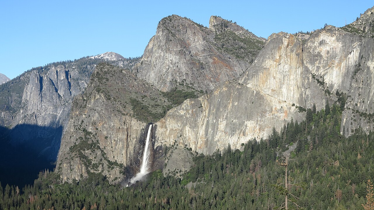
The viewing area is the endpoint that turns this into a clear short outing. Reach it on the provided path, observe the waterfall, and return on the maintained route. Rocks above and beyond the viewing area are not an unofficial extension to a closer photo position. Visually they may look like the same landscape as the paved approach, but they do not share its walking character. Stay with the route built for the visit instead of letting the apparent closeness of the water redefine the objective.
A useful photographic plan includes two scales: a wider view while approaching and a closer view from the designated area. The wider image explains how the water sits in the surrounding wall; the closer one records its texture or movement. Neither requires scrambling. If you cannot comfortably use the furthest part of the viewing area because of conditions or congestion, the approach can still provide an informative view. The last few steps should not become a compulsory test that determines whether the visit counts.
Short distance does not describe the spray
Bridalveil can create an intense sensory stop: moving air, noise, and water in the viewing area can dominate the experience. Those qualities vary, so do not plan the visit around a guarantee that everyone will stand in a particular position. Someone may enjoy seeing the waterfall from farther back while another person pauses briefly at the closer viewpoint. Make that difference easy to accommodate, with an agreed place to regroup rather than pressure to share one exact spot.
Pavement also does not promise a uniformly dry surface. The official trail guidance discusses slippery conditions around the waterfall, which is a reason to keep the outing within the maintained path and follow local instructions. The practical recommendation is to give the viewing stop flexibility: pause where the group is comfortable, protect equipment as appropriate to the conditions, and be willing to turn around. A half-mile trail is still a real outdoor visit, not a controlled indoor viewing platform with a fixed experience.
Where this stop fits geographically
Bridalveil belongs to the western end of the Yosemite Valley experience. It can make a focused introduction to the walls and waterfalls without requiring a circuit of the central valley first. Use that geographical role to simplify the day. If you are already planning another major hike, Bridalveil can be a separate short stop rather than the opening stage of an improvised longer walk. Keep the two activities distinct in your notes, including their different starts and returns.
Do not confuse proximity on the map with a ready-made pedestrian connection to every other attraction. The Valley Loop Trail is one way to plan a much longer valley-floor outing, but it is a different project from walking to Bridalveil's viewing area. If you want that longer context, research the relevant loop section and its return. If you simply want to see this waterfall at close range, choose the direct maintained approach and let that be sufficient.
Bridalveil or Lower Yosemite Fall?
Both are useful short waterfall walks, but their structure and setting differ. Bridalveil is a direct approach to one defined viewing destination at the western end of the valley. Lower Yosemite Fall uses a small paved circuit with two branches and views toward the broader Yosemite Falls system. Choose Bridalveil when a concise waterfall stop fits your geographical plan. Choose Lower Yosemite Fall when you want a little more circuit-style walking and the central-valley setting is already part of the day.
Doing both makes sense for somebody interested in comparing waterfall landscapes, but it should be a conscious comparison. Notice how each approach frames its waterfall and how the walls differ around it. If the group is looking for variety rather than a second waterfall, Cook's Meadow may add more than another close viewing stop. This is a better decision rule than adding both automatically because they appear on every first-visit list.
Accessibility and the whole visit
The official page identifies the western approach as wheelchair accessible, but anyone planning around a particular mobility requirement should consult the full current accessibility information. A general easy rating is not detailed enough to settle slopes, approach connections, or the conditions at the viewing area. Plan the entire route from your actual arrival point and decide whether everybody needs to follow precisely the same branch.
Finally, include the pauses in the visit rather than equating walking time with total time. The waterfall may invite a longer look, and the group may move more slowly around the viewing area than on the approach. Leave a comfortable gap before the next fixed activity. The advantage of Bridalveil is its clarity: a known start, a designated endpoint, and a straightforward return. Keep those strengths instead of complicating a short walk with unresearched extensions.
Questions answered
Is the half-mile figure for every Bridalveil approach?
No. It describes the official short outing from the designated starting area. Other connections add walking, so match a distance to its actual start.
Can I climb beyond the platform for a better picture?
Stay on the maintained path and designated viewing area. The nearby boulders are not a continuation of the short paved trail.
Is this the same kind of walk as Lower Yosemite Fall?
Both are short waterfall visits, but Bridalveil is a direct approach and return, while Lower Yosemite Fall provides a small circuit with distinct eastern and western branches.
Sources & scope
Route facts are drawn from the resources below. The comparisons and recommendations are our research-based editorial analysis; this is not a claim of personal trail inspection. Access and conditions must be checked with the responsible land manager before travel.
Editorial standards · Explore the destination guides
Found a detail that needs correcting? Send the guide URL and a supporting source so we can review the exact route version.